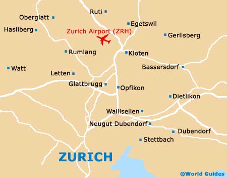
Zurich Airport (ZRH)
Orientation and Maps
(Zurich, Switzerland)
Zurich lies on the northern outskirts of Switzerland, close to the southern German border. The city of Zurich boasts a population exceeding 350,000 and is known for its banking heritage and finance. However, these days Zurich is a major tourist hotspot and has seen a boom in tourism, resulting in the arrival of many top restaurants and trendy bars.
Most people flying into the region choose to use Zurich Airport (ZRH), which occupies a large area on the northern side of the city's suburbs. The public transport network in Zurich is superb and incorporates a bus, train and S-Bahn train service, together with regular passenger boats along the Limmat River. Zurich's train station is located on the western bank of the river and is known as the 'Hauptbahnhof'.
Zurich Airport (ZRH) Maps: Important City Districts
The city of Zurich stands on the northern side of Zürichsee, with the very heart of the city being divided by the meandering Limmat River. The river is an important point of reference in Zurich and is lined by countless significant points of interest and prominent buildings.
Many tourists visiting the city choose to purchase a 'ZurichCard', which can be found at a range of outlets, including the tourism centre, the railway stations and also at local hotels. This card allows free access to public transport in Zurich, together with entry to many top attractions, including more than 40 different museums.
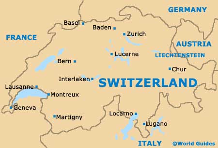
Switzerland Map
Zurich Map