Zurich Airport (ZRH)
Driving Directions / Travel by Car
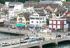
(Zurich, Switzerland)
Zurich Airport (ZRH) is situated just 12 km / 7 miles north of the city of Zurich. The airport lies at the centre of Switzerland's road system and it has excellent connections with other cities in Switzerland and Europe.
The grounds of Zurich Airport are known locally as the 'Flughafen Zürich-Kloten' and lie alongside the towns and villages of Rümlang, Baschenbüulach, Winkel, Niderrüuti and Kloten, amongst others.
Directions to Zurich Airport from the north of Switzerland:
- From the north of the city, take motorways A2 / A3 / A4 / A14 / A40 towards Zurich
- Turn off onto motorway A51 and follow signs to Zurich Airport
Directions to Zurich Airport from the east of Switzerland:
- Coming from the east of Switzerland, take any of the following motorways to Zurich: A1 / A2 / A3 / A5 / A6 / A12 or A20
- Join the A51 motorway and follow the signs for Zurich Airport
Directions to Zurich Airport from the south of Switzerland:
- Travelling to the city from the south, take one of the following motorways to Zurich: A2 / A3 / A4 / A14 or A40
- At Zurich, join the A51 motorway and follow signs for the airport
Directions to Zurich Airport from the west of Switzerland:
- Coming from the west of Switzerland, take one of the following motorways to Zurich: A1 / A2 / A3 / A5 / A6 / A12 or A20
- At Zurich, follow signs for the A51 motorway
- Once on the A51 motorway, follow signs for Zurich Airport
The roads in Switzerland are in excellent condition and are well signposted, making it easily navigable by car. When travelling to Zurich Airport, you should allow extra time in your travel schedule for unforeseen and unpredicatable delays.
Zurich Airport (ZRH): Virtual Google Maps
